
Okay y’all… live radar maps are legit the only reason I’m not currently hiding under my couch every time the sky turns that weird bruised green color.
I’m sitting here in early January 2026 (weirdly warm again, thanks climate) in my little apartment outside Chicago, windows rattling because of course there’s another damn squall line sliding through the Midwest tonight, and I’ve got like four different radar tabs open. Seriously. Four.
The main one I keep coming back to — and I swear I’m not getting paid to say this — is the RadarScope app. I know, I know, it costs money. But listen… once you go full nerd mode with the Level II data and velocity couplets and all that jazz, the free stuff just feels like looking at a potato through foggy glasses.
Here’s the embarrassing part: last spring I was driving back from St. Louis and got absolutely fixated on this little red hook echo developing near Springfield, IL. I was so busy staring at my phone’s live radar maps that I almost rear-ended a semi. Real smooth. Real adult.
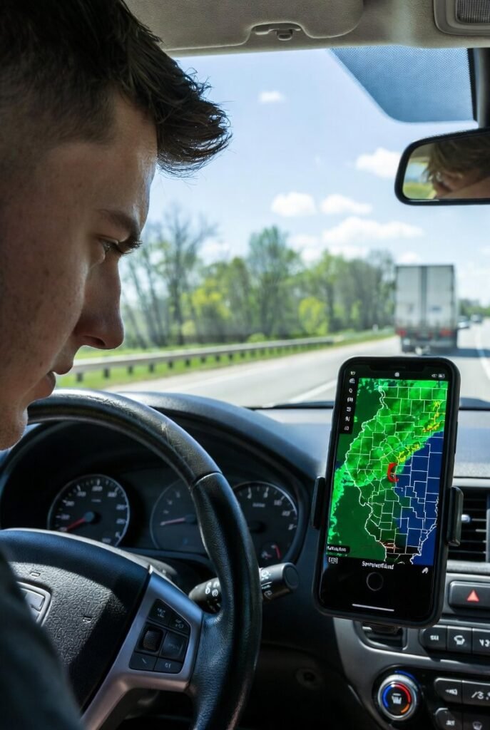
So yeah. That’s me. The guy who almost became a statistic because he was too busy tracking storms across the U.S instead of watching the actual road.
My Go-To Live Radar Maps Tools in 2025–2026 (that I actually use)
- RadarScope — expensive but god-tier. The velocity and storm-relative motion layers are stupid good.
- NOAA Radar (weather.gov) — free, classic, reliable, looks like it was designed in 1997 and I kinda love it for that
- Windy.com — the ECMWF + GFS models layered on radar? Chef’s kiss when you’re trying to guess if the supercell is gonna survive the night
- MyRadar — the pretty one. Very swipeable. Great for when your brain is too fried for technical data
- Radar Live (AccuWeather) — surprisingly decent future radar animation these days
I rotate between them like a crazy person depending on my mood and how much adrenaline is currently pumping through my veins.
Quick Story Time (the one that still makes me cringe)
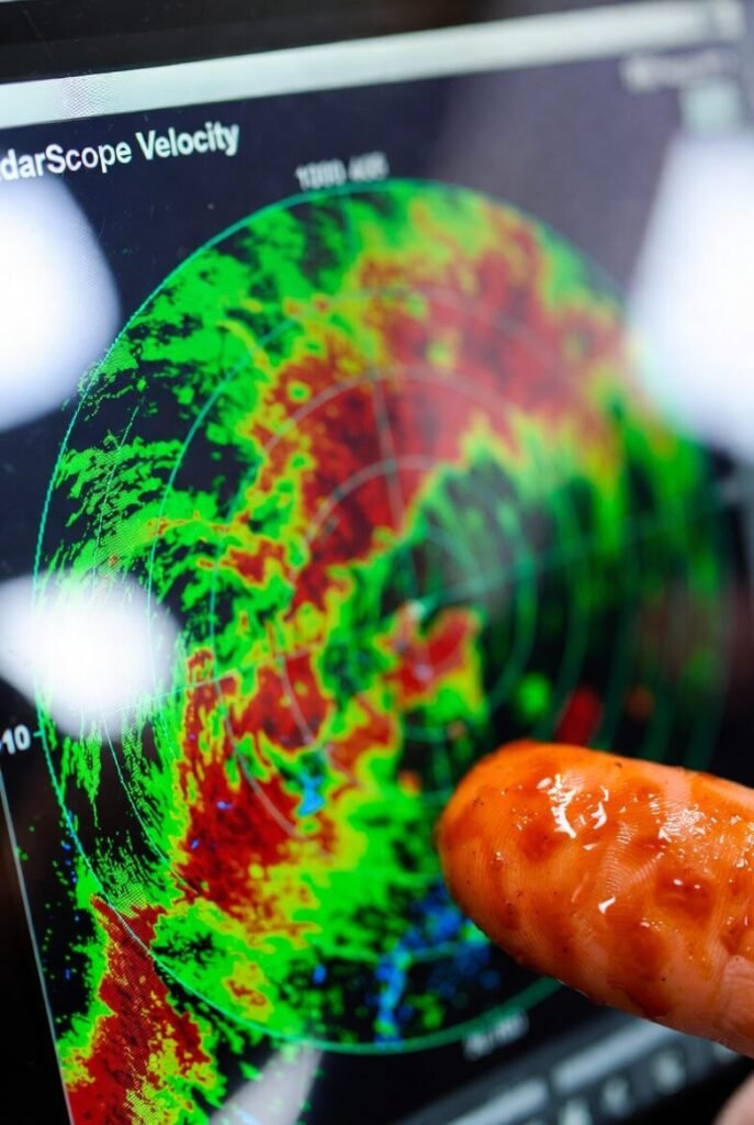
July 2025. Central Iowa. I’m visiting family. The sky goes black at like 4:30pm. Phones start screaming with tornado warnings. I pull up live radar maps (RadarScope, naturally) and there it is — textbook supercell with a perfect hook echo and insane rotational couplet. I yell “WE GOTTA GO TO THE BASEMENT” like I’m some kind of storm prophet. My 9-year-old nephew looks at me dead serious and goes: “Uncle you’ve been staring at your phone for 40 minutes. Maybe YOU should go to the basement.”
He wasn’t wrong.
Here’s the radar screenshot I took right before we went downstairs (yes I took a screenshot before evacuating, judge me):
Tips From Someone Who’s Way Too Obsessed With This Shit
- Learn what VIL (Vertically Integrated Liquid) actually means — helps you know if that red blob is baseballs or just heavy rain
- Velocity couplets > pretty reflectivity almost every time when you’re trying to spot actual rotation
- If you see “3-body scatter spike” on radar, there are probably giant hailstones somewhere nearby
- Turn your phone brightness all the way up at night — you will look like a lunatic but you’ll actually see the radar colors
- Don’t trust future radar when a storm is right on the edge of the convection-allowing zone (it lies, it lies so much)
Anyway.
If you’re like me and you live in a part of the country where the sky occasionally tries to murder you, having good live radar maps on your phone isn’t optional. It’s borderline survival equipment.
Stay safe out there, check those storms, and maybe… maybe don’t almost crash your car while doing it.
You got a favorite radar app or site I missed? Drop it in the comments — I’m always looking for new ways to feed my weather neurosis.